Research
[An expedition] having for its main and probably for its sole object the extension of Geographical knowledge, . . . seems much more of a nature to contribute in the character of an expedition of discovery . . . .
— Jeremy Bentham to Francis Osborne (16 July 1785)
Mapping, imaging, gazetteering
It has always been our ambition for Electronic Enlightenment to provide resources and undertake and support research into the mapping of historical information associated with our network of correspondence. "Mapping" means much more than map images; it also means the ability to track the movement of people, documents and — eventually — ideas across the global reaches of early modern history.
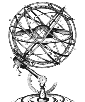
engraving of an armillary from the
Encyclopaedia Britannica, 1st ed. (1771)
Our Map room is now the centre of this exciting new activity, which has already started to make images of beautiful and historical maps available in our EE Atlas, using Microsoft's remarkable Seadragon software and scans of maps from some of the best archives in the world.
Now, as part of JISC's Digging into Data award, EE will be extending information about the sources, the destinations and the likely routes of travel of people and documents; and our gazetteer will be pulling together variants across languages and periods.
On the Map room's "research" pages, you will be able to track our progress on gazetteering, imaging and mapping the geographical dimensions of EE's data. This will include work in progress, which we will be making freely available as we proceed.